Common Operating Environment

Project Details
The Rail Sector Common Operating Environment (COE) provides the North American rail industry with a unified system for safety and security incident data collection, analysis, reporting, and decision-support capabilities.
In 2012, the rail industry sought to develop a commercial-grade, industry-wide system for reporting events relevant to railroad security stakeholders. Through an initial three-phased development process and ongoing enhancements, FACTOR has created a robust, web-based security data system that supports a full range of incident management needs for the rail industry.
As industry-wide usage of the COE expanded for security management, rail industry hazmat professionals recognized the potential of the system for managing hazmat spill and response resource information. FACTOR then developed the Hazmat Release and Emergency Response Resource Inventories within the COE to meet the needs of this expanding user base. The resulting system enables railroad stakeholders to organize, visualize, communicate, and mine both safety and security information critical to the operation of the industry.
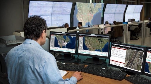
The COE is currently used by dozens of North American railroads, including each of the Class I carriers. Users rely on the GIS-enabled system for situational awareness, real-time event reporting and alerting, secure data storage and communication, resource planning, and, for events of significant concern, notification of federal law enforcement. The COE is flexible, secure, yet accessible, and focused on the rail industry’s operational needs, helping railroads to minimize safety and security events and their potential impacts on the industry and society.
Insights

The COE is a commercial-grade system with the American Association of Railroads (AAR), the North American Rail Industry, and partners in law enforcement and emergency response.
COE provides situational awareness
The COE is currently being used by all seven of America’s Class 1 freight railroads in daily operations. Users rely on the GIS-enabled system for situational awareness, real-time event reporting and alerting, secure data storage and communication, resource planning, and, for events of significant concern, notification of federal law enforcement.

Related Services

Information Technology Solutions

Geospatial Solutions
Related Industries
Rail
Here are some of the tools and techniques we use for the Common Operating Environment
SQL Server Spatial
Microsoft’s SQL Server database environment supports both geographic and projected data types and can support a wide range of geoprocessing functions directly in the database.
Geospatial Web Services
Web Services tied to ArcGIS servers support complex, performance-intensive geospatial computations and tool development that can be shared with users anywhere.
ArcGIS for Server
Supports complex, performance-intensive geospatial computations and tool development that can be shared with users anywhere.


